Waking up this last morning, I could feel the fire in my legs. Everything had tightened up overnight. I guess I should have expected it for day 3. I was expecting it yesterday. I sat up and began to stretch.
I had mentioned making sure to bring the ibuprofen, also in the “Geezer’s Guide to Hiking” is frequent stretching. Every muscle you have is going to work, but I start frequent stretching days in advance of hiking and every chance I get along the trail. Even just a hamstring and calf stretch. Needless to say, this morning was rough.
I looked at the clock and it was 6 AM. Even moving slow I figured we’d be on the trail in an hour or so. Bessie climbed out of the tent ready to start hiking. I laughed, we had our little morning conversation, I started breakfast and fed Bessie. I continued sipping water. I was feeling a lot better hydration wise this morning.
Looking at my water supply and knowing I only had a few miles left to the trek, all uphill, I decided we weren’t going to load up on water and the 2 liters I had left should get us to the top.
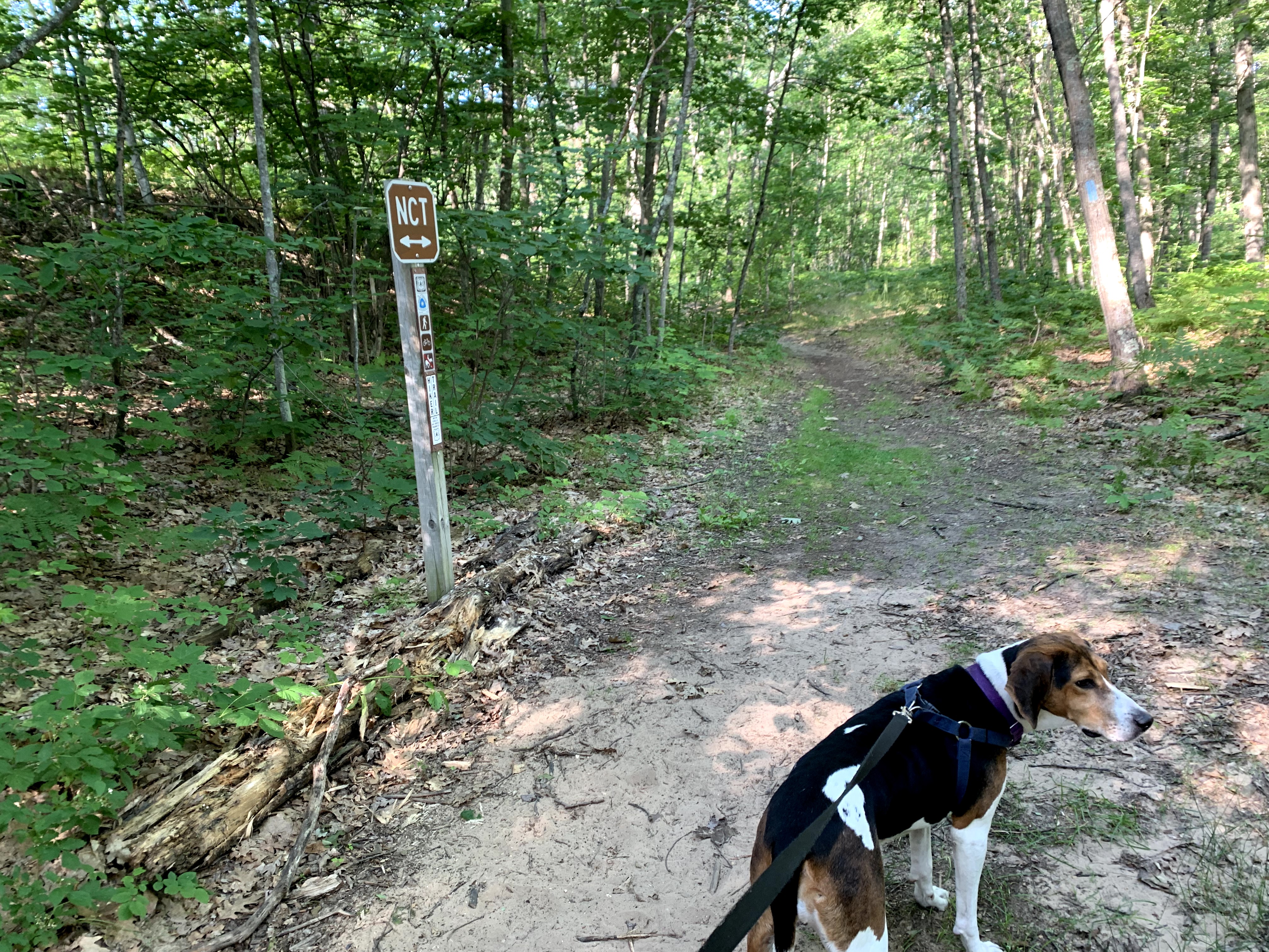
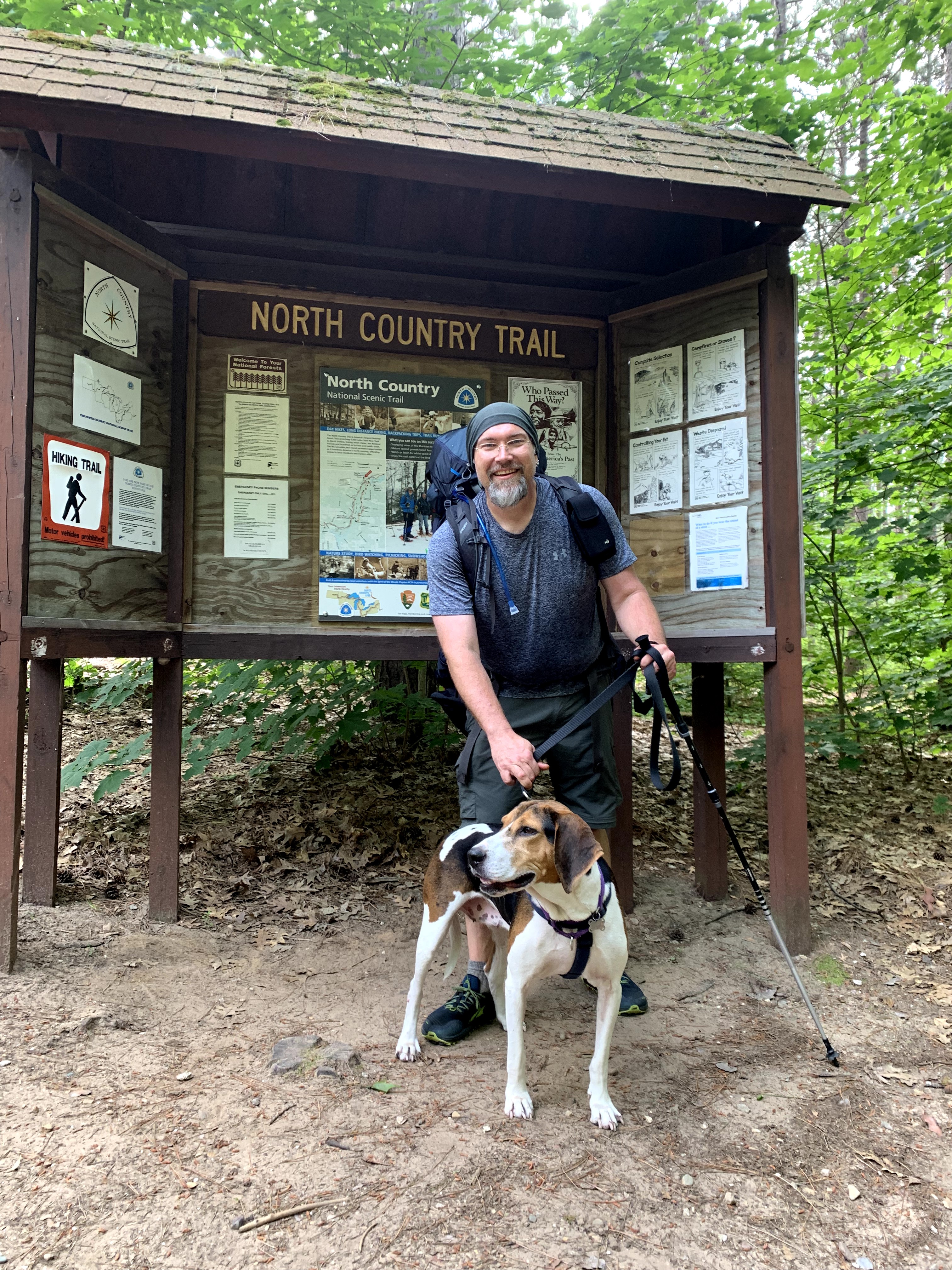
I packed up making sure we left no trace at the campsite and we headed up the stub trail connecting back in with the NCT.
The morning coolness was a relief from the last 2 days. The high for today was 80 and it was a cool 70 degree morning even with the humidity still in the air. The woods had that morning smell that makes me feel like I am where I should be.
The last stretch had a short road hike before meeting back with the trailhead stub trail. The circle had been completed. Now for the rest of the climb. We were already about 200 feet up from camp with another 300 along the valley hill.
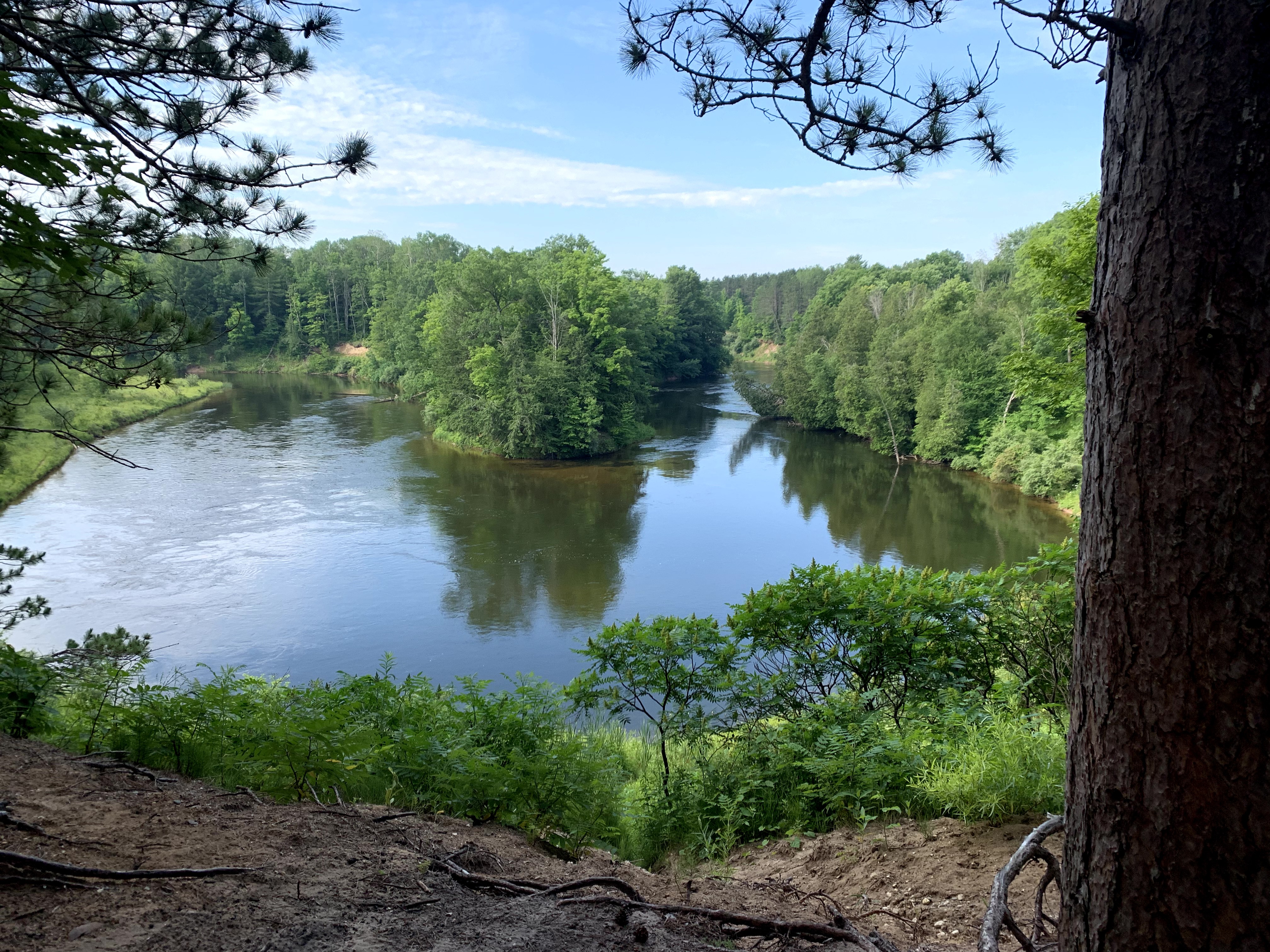
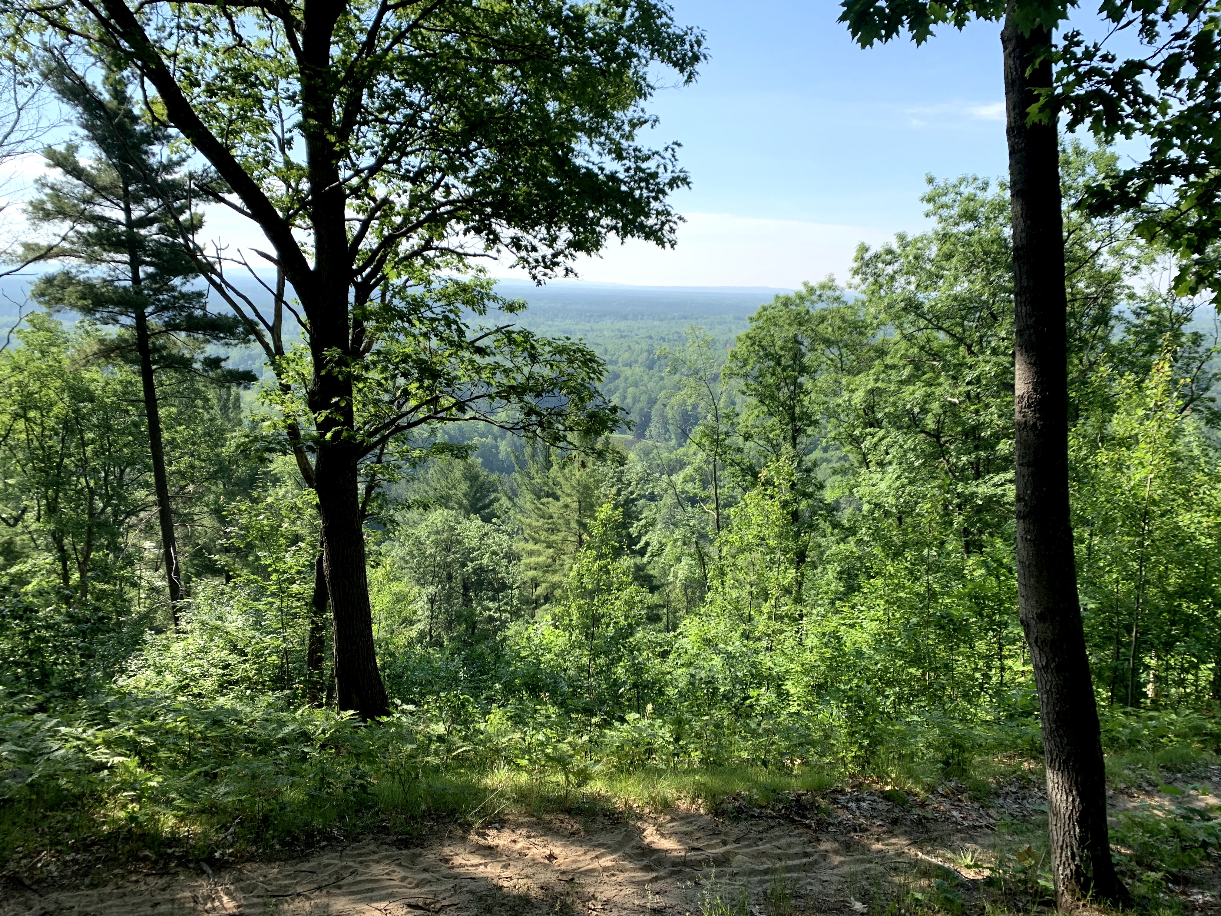
I had to take a couple of breaks along the way up. I was glad this was going to be a “nero” day (near 0 miles for the day for those unfamiliar with backpacking lingo compared to a zero day where you rest and don’t hike at all). Finally after all the climbing I could see the top and the bench we passed at the beginning. I sat down for my final rest. The valley was stunning, reminding me how far I hiked.
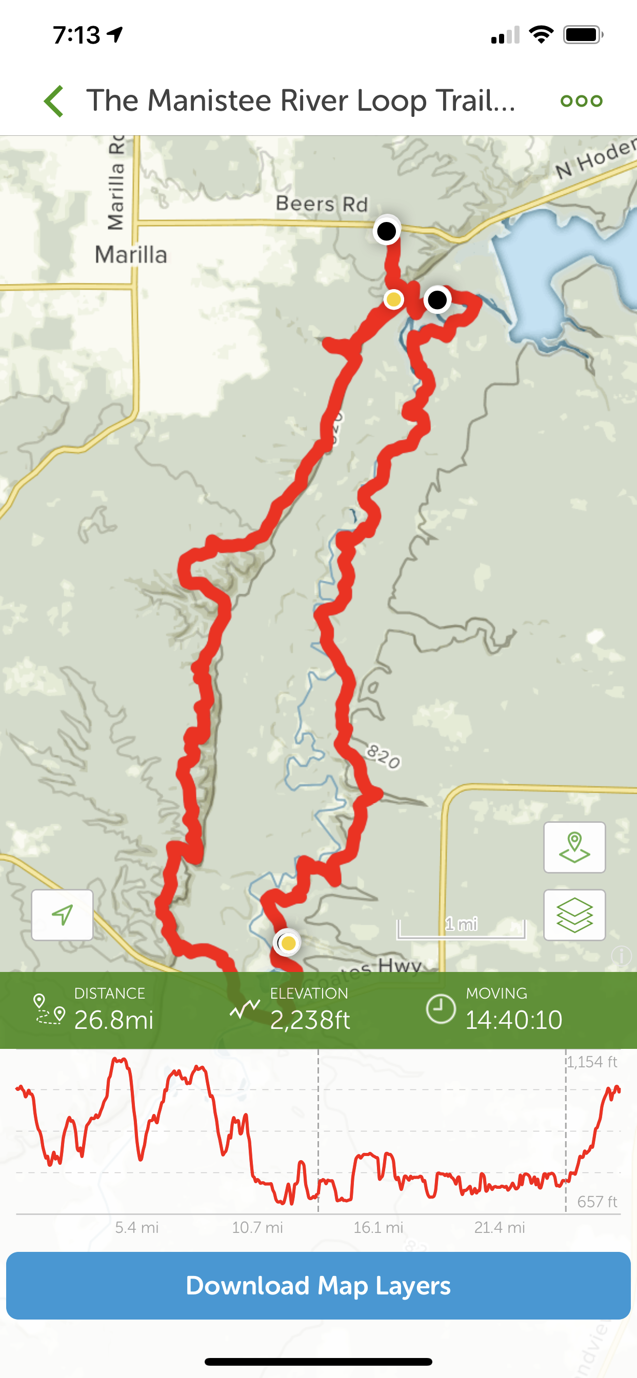
Once it flattened out it was about a half mile to the car. I thought today was going to be 4 miles but actually worked out to be about 2 1/2. Several maps had conflicting data on the loop length, plus that doesn’t account for the trailhead stubs. I had planned on 30 miles, but came out at 26.6.
Seeing the Explorer was a relief and at the same time disappointment that Bessie and my journey was over for now.
I spent the rest of the day and the next relaxing (ok, I’m lying, I went out that night to see my friends’ band Stealin’ the Farm however looked like an old man trying to walk). Two days later I was ready to go hiking again.